İstanbul in Numbers
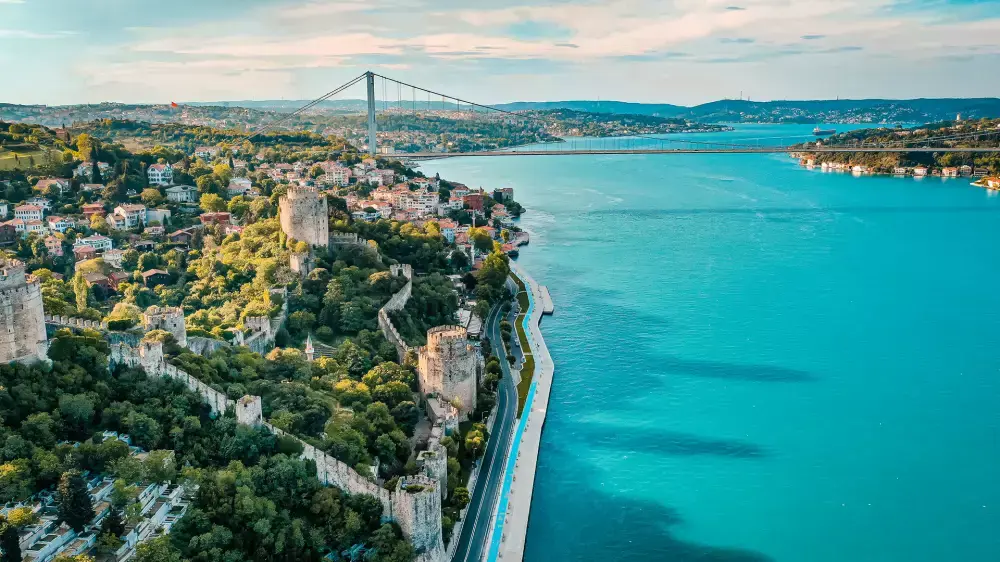
A city unique in the world with a location on two continents, İstanbul is located over a surface area of 5 thousand 343 km2, which ranks it 64th among the cities in Turkey. According to official statistics for 2019, it has a population of 15 million 519 thousand 267, representing an increase of 451 thousand 543 people, namely a 3% rise when compared with the figures of the previous year. This makes it the most populated city in the country.
Of this population, 50.20% are men and 49.80% women, with 7 million 790 thousand 256 and 7 million 729 thousand 11 man and woman population, respectively. Official figures reveal that it has a population density of almost 3000 people per kilometre, with Esenyurt being the most populous district with a population of 954 thousand 579 people.
The province of İstanbul has 39 districts and 964 quarters. The traffic licence number of the province is 34, and the area telephone code numbers of the European and Asian side of the province are 212 and 216, respectively. Above we have made mention of Esenyurt, the most populous district in the province. Other districts are; Adalar, Arnavutköy, Ataşehir, Avcılar, Bağcılar, Bahçelievler, Bakırköy, Başakşehir, Bayrampaşa, Beşiktaş, Beykoz, Beylikdüzü, Beyoğlu, Büyükçekmece, Çatalca, Çekmeköy, Esenler, Esenyurt, Eyüpsultan, Fatih, Gaziosmanpaşa, Güngören, Kadıköy, Kağıthane, Kartal, Küçükçekmece, Maltepe, Pendik, Sancaktepe, Sarıyer, Silivri, Sultangazi, Şile, Şişli, Tuzla, Ümraniye, Üsküdar and Zeytinburnu.
This city described as the most beautiful city in the world is situated at the latitude 41 degrees north and the longitude 29 degrees east. The area called the Historical Peninsula is situated on seven hills, namely Topkapı Palace Hill, Çemberlitaş Hill, Beyazıt Hill, Fatih Hill, Yavuzselim Hill, Edirnekapı Hill, and Kocamustafapaşa Hill, therefore the name ‘’İstanbul, City on Seven Hills’’.
With Aydos Hill, Kayış Mountain, and Alemdağ Hill with a height of 537, 438 and 442 metres, respectively, the province of İstanbul is located rather on a non-mountainous landscape. As for the structure of the surface, 74% is covered with plateaus, 9.5% with low lands, and 16.1% with low mountains and hills. Büyükçekmece, Küçükçekmece, and Durusu are the most important lakes. The bays and coves at the Golden Horn, Tarabya, and İstinye make up one of the best examples of Ria type coastal line.
Accounting for 55% of the production and 45% of the commercial activities in Turkey, İstanbul has a leading position in the trade community in Turkey as well. It also generates 21.2% of the Gross National Product of Turkey and realises 45.2% of the exports and 52.2% of the imports of the country.
At home, İstanbul is generally described as ''the city with golden opportunities'', but it has a soil inventory so rich, fruitful and also very suitable for forestation that people say, ''the soil is so fertile that it enables any plant to grow''. It is however observed that the distribution of the tree species in the forests and woodlands in the province is very irregular. Nonetheless, the northern parts of the province at the Black Sea coastal line and northern slopes of the hills have a soil type rich in humus providing a favourable environment for hygrophilous forests. The southern parts are characterised by a tree population resistant to drought. It is an unfortunate fact that in the last five decades the forest population in the province has diminished by half, a trend contrary to a rise in human population in the same period.
İstanbul has a transitional climate influenced by the Black Sea and Mediterranean climates. Accordingly, it is located in a climate zone of a mild character, with humid and hot summers, and rainy and cold winter months, characterised with temperatures varying between 2 and 9 0C in winter and between 18 and 28 0C in summer, especially in July and August.
Depending on such climatic and geological features, İstanbul annually receives an average rainfall amount of 843,9 millimetres, of which 38% falls in winter months, 18% in the spring, and 13% in autumn. The highest temperature ever experienced in the city was 40.5 0C recorded on July 12, 2000, and the lowest one, on the other hand, was -16.1 0C that was recorded on February 9, 1929.
Now a few words about the flora in the area. İstanbul has such a wonderful natural environment that it provides habitat to 2.500 plant species all across the province, a figure that represents one-fourth of the overall plants in Turkey. While, of these, about 200 plants are flowery, 40 are endemic species, namely plants exclusively found in İstanbul. Parallel to an increase in the human population, nowadays many of these plants are unfortunately on the verge of becoming extinct.
Some of the plants that are at risk of becoming extinct are; İstanbul crocus, İstanbul snowdrop, knapweed of Çatalca, knapweed of Kilyos, Pendik thorow wax, and linen of Bosporus.
Now, in conclusion, allow me to say a few about the water resources of the province. There are nine dams in the province, the most important and biggest ones being Ömerli, Terkos, Büyükçekmece, Darlık, and Sazlıdere. Besides, rivers and brooks also provide water to the city, the biggest brooks being Riva, Kağıthane, Alibey, Göksu, Kurbağlı, and Ayamama.


